
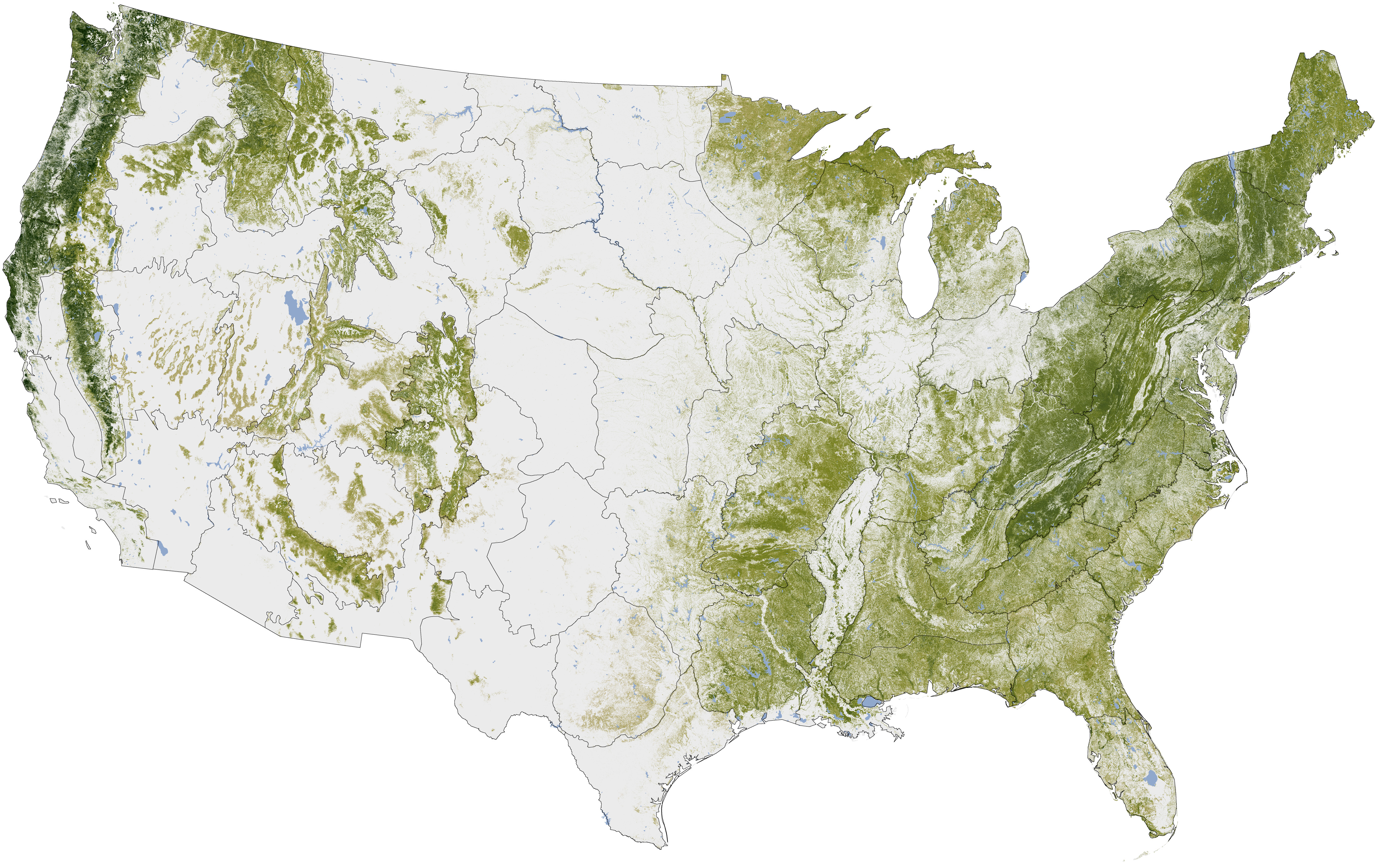
Trees of the US mappedFriday 3 Feb 2012 It seems like an insanely difficult task: inventory all the trees of the United States. But that’s just what Woods Hole Research Center, the U.S. Forest Service and U.S. Geological Survey undertook. The end result: a high resolution map of where all the trees are located.The map is part of an ongoing project to see how the Earth’s trees are doing at storing carbon. The data was mined from satellites, computer models and research on the ground. Scientists hope it will help them see how much carbon the United States is losing or gaining over time. Click here for the full size image.  |
Copyright 2004-2026 © Innovatek Ltd. All rights reserved. |